
Rockford Scanner
News, Editorials, Events, Paranormal,
Sports, Weather, Letters to the Editor, Reviews, Opinions,
Police Scanner, Advertisements, Humor, Jokes, Satire, Parody,
Whatever we feel like posting about…

We strongly recommend you doing your own research,
And forming your own opinions.

Donate | Contact RS | Sponsors | Paranormal Files | FOIA Requests|
F.A.Q. | Plane Spotting | Contest | Ham Radio | Local Frequencies |
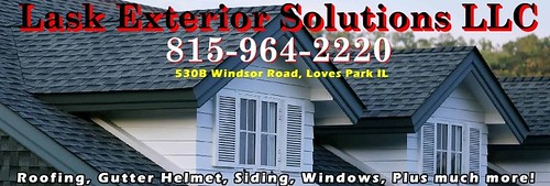
If you get any storm damages,
Lask Exterior Solutions can replace your roof, windows, doors, Plus much more!
THE NATIONAL WEATHER SERVICE HAS ISSUED TORNADO WATCH 154 IN
EFFECT UNTIL 8 PM CDT THIS EVENING FOR THE FOLLOWING AREAS

IN ILLINOIS THIS WATCH INCLUDES 16 COUNTIES

IN CENTRAL ILLINOIS

LIVINGSTON

IN NORTH CENTRAL ILLINOIS

BOONE                 DE KALB               LA SALLE
LEE                   OGLE                  WINNEBAGO

IN NORTHEAST ILLINOIS

COOK                  DUPAGE                GRUNDY
KANE                  KANKAKEE              KENDALL
LAKE IL               MCHENRY               WILL

THIS INCLUDES THE CITIES OF ALGONQUIN, AURORA, BELVIDERE,
BOLINGBROOK, BOURBONNAIS, BUFFALO GROVE, BYRON, CAROL STREAM,
CHICAGO, COAL CITY, CRYSTAL LAKE, DEKALB, DIXON, DOWNERS GROVE,
DWIGHT, ELGIN, EVANSTON, FAIRBURY, GURNEE, JOLIET, KANKAKEE,
LA SALLE, LEMONT, LOMBARD, MARSEILLES, MCHENRY, MENDOTA, MINOOKA,
MORRIS, MUNDELEIN, NAPERVILLE, OAK LAWN, OREGON, ORLAND PARK,
OSWEGO, OTTAWA, PARK FOREST, PLANO, PONTIAC, ROCHELLE, ROCKFORD,
SCHAUMBURG, STREATOR, SYCAMORE, WAUKEGAN, WHEATON, WILMINGTON,
WOODSTOCK, AND YORKVILLE.
.MESOSCALE DISCUSSION...
Issued at 206 PM CDT Thu Apr 20 2023

Thunderstorms are erupting within a narrow moisture axis near the
Mississippi River with a predominant supercell storm mode thus
far. Aggressive southwesterly winds gusting 30-35kt will continue
to advect the moisture plume northeastward, with the expectation
for thunderstorms to expand in coverage and continue unabated into
northern Illinois later this afternoon. The primarily threats
remain damaging hail and wind. However, we can't ignore the
tornado threat given strong low-level shear with recent VWP-
derived hodographs from KDVN showing nearly 350 J/kg of 0-1km SRH.
However, we would tend to think the best low-level flow will lift
northward into Wisconsin closer to the surface low. Regardless, a
Tornado Watch is now in effect for areas generally along and
northwest of I-57 until 8 PM CDT.

We time the arrival of the first thunderstorms to
Ogle/Lee/LaSalle counties in approximately 2-3 hours.

PREVIOUS MESOSCALE DISCUSSION...
Issued at 1116 AM CDT Thu Apr 20 2023

A recent hand surface analysis augmented by regional satellite
imagery depicts a warm front arcing from near Cleveland, Ohio
northwestward to Milwaukee, Wisconsin and into a convectively
invigorated low pressure system with minimum pressure of 999mb near
Cedar Rapids, Iowa. A cold front arcs southward from the center of
low pressure from central Iowa into western Missouri and eastern
Oklahoma. The warm sector bounded by both fronts is somewhat "dirty"
at this hour with showers and a few thunderstorms mainly across
Illinois within a leftover region of low-level WAA along the
southeastern flank of the aforementioned low to the northwest.
Regional soundings show an impressive elevated mixed layer (EML) is
in place across the Mississippi River Valley with both the 12Z
DVN/ILX RAOBs sampling 800-600mb lapse rates of nearly 9 K/km atop a
stout low-level inversion (+15 to +16C at 850mb). Low-level moisture
is relatively scant locally at this hour, though a narrow plume of
55 to 60 degree dew points stretches from near the Quad Cities
southwestward toward Joplin, Missouri. Where the steep mid-level
lapse rates overlap with the narrow tongue of low-level moisture is
a similarly-narrow plume of low-level instability characterized by
MLCAPE of 1000-1500 J/kg.

Water vapor imagery depicts a region of accelerated flow across the
southern and central Plains, which was confirmed by the 12Z AMA/TOP
RAOBs sampling 75 to 100 kt from 500-250mb. As the speed max rounds
the base of an expansive upper-level trough across the central US
this afternoon, upper-level height falls and warming surface
temperatures will erode surface-based inhibition within the narrow
low-level instability plume. Indeed, bands of thunderstorms appear
poised to develop along and just ahead of the eastward-moving cold
front first near the Mississippi River this afternoon and then
eastward across Illinois. As storms progress toward Indiana, they
may tend to outrun the low-level instability plume leading to a
gradual weakening trend.

With forecast MLCAPE of 1500-2000 J/kg and 0-6km deep-layer shear of
45-55 kt, storm organization will be easily attainable supporting a
threat for severe weather. Roughly 30 to perhaps 45 degree angles
between deep-layer shear vectors and the cold front will support a
semi-discrete storm mode with both clusters and transient
supercellular structures probable. Accordingly, damaging winds and
hail may accompany any thunderstorm this afternoon. While low-level
wind profiles will suffer from a relative "straight" shape (e.g.
somewhat veered low-level wind profiles), a few tornadoes cannot be
ruled out particularly with any sustained supercell. If any
localized backing can materialize, the threat for tornadoes would
increase.

The severe weather threat should be from 2 to 6 PM along/west of I-
39, between 5 PM and 9 PM between I-39 and Lake Michigan. If storms
continue into northwestern Indiana, the threat could continue
through 10 or 11 PM CDT.
As much as we hate asking for donations.
Sadly, it does cost money to run RS.
Dedicated server, Domain, Maintenance, Time, etc…
Every penny helps!
Donate via debit or credit card:
CLICK HERE
Thank you in advance for your donation!
Officials have not yet released any information:
- To confirm anything (Nothing is confirmed),
- On the incident (What happened?),
- Possible alleged suspects, (Who may be involved?),
- If there is a possible threat to the community (Community in danger?),
- Who to possibly be on the lookout for, (Who to be on the lookout for?),
- If they do release information, we will update this.
If there are no updates, officials have not released any information that we are aware of.
Facts: Simple communication and transparency
WOULD eliminate any misinformation or exaggerations
Our opinion on what allegedly may have happened,
Based on the information that has currently been provided to us.
Any Errors/Corrections, Please Contact Us: RockfordScanner@gmail.com
A simple email saying: “That is not what happened, but this IS what happened”
Rockford Scanner
See it, Snap it, Send it
- SEE IT: See a scene or something of interest
- SNAP IT: Pull our your camera and film
- SEND IT: RockfordScanner@Gmail.com
CLICK HERE TO DONATE
Thank you in advance for your donation!

Visit our sponsors:
CLICK HERE
Checkout one of the best
Police scanner on the market!
 Our personal opinions on various topics.
Rockford Scanner
PARANORMAL FILES!

Disclaimer:
- Our content is for entertainment purposes only.
- Informative entertainment.
- All the information posted, is our own personal opinions.
- Our personal opinions.
- Our opinions on what allegedly may have possibly have happened.
Based on the information that was currently provided to us, at the time of posting it. - We strongly recommend you doing your own research, and forming your own opinion.
- We are protected by the 1st amendment.
- Everyone is innocent, until proven guilty in a court of law.
- We can not guarantee the accuracy of our content.
Information is very dynamic and may change. - If you know of any corrections, please contact us right away.
RockfordScanner@gmail.com - You must read and agree to our terms.
If you do not agree with our terms, please leave now.
Our information is for entertainment purposes only. Because of this, We can not guarantee the accuracy of our information. If you know of any errors, please contact us at RockfordScanner@gmail.com and please provide us with the proof of the correction. We strive for accuracy. But, the information is always dynamic and changes often with our type of content. Because of this, We do apologize ahead of time if there are any errors. So, Please let us know of any updates or errors! We are protected under the first amendment.
Disclaimer and Terms:
CLICK HERE