
Rockford Scanner
Bringing you news and entertainment
in the Rockford, IL area.
Rockford’s Popular Entertainment Website.

Contributing to
Rockford Scanner’s Mission
THANK YOU for donating to Rockford Scanner! I cannot say enough. Keep up the amazing work! And THANK YOU to everyone who might donate in the future.
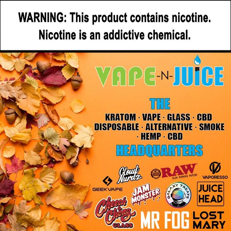
THANK YOU for donating to Rockford Scanner: BUSSINESSES: Lask Exterior Solutions, Vape-n-Juice, Attorney Paul Marriett, Wicked Tires, First Shot Firearm Training and concealed Carry! Racheal, Jessica, Mellissa, Henry, Indy, Nichole, Monique, Anthony, Wendy, Frank, Sam, Sonya, Denise, Angela!! And THANK YOU, to everyone who might donate in the future.
 Day 1 Convective Outlook
   NWS Storm Prediction Center Norman OK
   1259 AM CDT Mon Apr 28 2025

   Valid 281200Z - 291200Z

   ...THERE IS A MODERATE RISK OF SEVERE THUNDERSTORMS FOR SOUTHERN
   MINNESOTA...NORTHERN IOWA...AND WESTERN WISCONSIN...

   ...SUMMARY...
   Multiple corridors of severe thunderstorms are expected across the
   Upper Midwest later today into tonight, with a regional severe
   weather outbreak possible. The most dangerous period is likely
   during the late afternoon and evening when strong tornado potential
   should be maximized. Scattered large to very large hail and damaging
   winds are likely as well.

   ...Synopsis...
   A positively tilted mid/upper-level shortwave trough, with several
   embedded vorticity maxima, will move east-northeast through the day
   across the Great Plains and Upper Midwest. The southwest portion of
   the large-scale trough and an embedded midlevel cyclone will remain
   in place near the Four Corners through most of the period. A strong
   midlevel jet (70+ kt at 500 mb) will move from the central Plains
   toward the upper Midwest/Great Lakes later today into this evening.
   The primary surface cyclone will move from the eastern Dakotas
   toward the upper Great Lakes, as a trailing cold front moves through
   parts of the Great Plains and eventually the Upper Midwest. By late
   afternoon, a dryline will extend from near the MN/IA border
   southwestward into the southern High Plains.

   ...Upper Midwest...
   A regional severe weather outbreak still appears possible across the
   Upper Midwest, with a threat of strong tornadoes, very large hail,
   and swaths of damaging winds. No major changes have been made to the
   Moderate and Enhanced Risk areas.

   Extensive elevated convection and a possible MCS will likely be
   ongoing at the start of the forecast period across parts of ND/MN,
   and may tend to redevelop through the day. This could slow the
   northward advance of the warm front to some extent, but 60s F
   dewpoints are expected reach at least central MN into northern WI by
   mid/late afternoon.

   South of the warm front and east of the dryline, the environment is
   expected to become increasingly volatile through the afternoon, with
   strong instability (MLCAPE near/above 3000 J/kg) and deep-layer
   shear, and a persistently intense low-level jet that will maintain
   very favorable low-level shear/SRH. This environment will be
   conditionally favorable for long-track supercells with
   strong/intense tornado potential.

   Uncertainty remains regarding the evolution of diurnal convection
   across the warm sector. Guidance generally suggests that
   surface-based storms will develop near the surface low and along the
   prefrontal trough/dryline across southern MN, which could evolve
   quickly into a cluster or linear mode, though the environment would
   still support embedded supercell potential with all severe hazards
   possible. If development in this area is able to remain
   semi-discrete, then a couple long-track tornadic supercells could
   occur.

   Farther south into IA, stronger heating/mixing is expected near the
   dryline, though large-scale ascent and low-level convergence may be
   somewhat weaker compared to areas farther north. While guidance
   varies regarding the potential for development across IA during the
   afternoon, any supercell that can initiate and be sustained could
   become long-tracked within the expanding and very favorable warm
   sector, posing a threat for strong to intense tornadoes and very
   large hail.

   As the surface low and related boundaries move eastward, organized
   convection may develop in place and/or spread into parts of WI, with
   a threat of all severe hazards and some strong-tornado potential.

   Farther west, a couple of supercells may develop in the region
   between the prefrontal trough/dryline and cold front, and pose a
   threat of large hail and locally damaging gusts as they move across
   northeast NE/southeast SD into parts of MN/IA.

   ...Parts of KS/MO into the Southern Plains...
   While large-scale ascent will be comparatively weaker from KS/MO
   into the southern Plains, isolated to widely scattered storm
   development will be possible within a weakly capped environment.
   Instability and deep-layer shear will both be moderate to strong by
   late afternoon into the evening, and a few supercells may develop
   near the dryline. Large to very large hail and locally damaging
   winds will likely be the initial primary hazard, but increasing
   low-level SRH by early evening will result in some tornado threat as
   well. Additional strong to locally severe storm development will be
   possible overnight near the advancing cold front, aided by a
   continued nocturnal strengthening of the low-level jet.
We also accept the following donations:
———> Estates, Houses, Money, Vehicles, Land, Stock, CD’s, etc… <———
Contact us at: RockfordScanner.com
Thank You in advance for your donation!
If you like our page, please show your gratitude!

*** A simple anonymous email saying ***
“Hey that is not what happened,
But this “IS” what happened…”
Email us at
RockfordScanner@gmail.com
——> Simple communication and transparency,
Would eliminate any misinformation or exaggerations.

815-964-2220
Vape-N-Juice located at:
Windsor and Alpine.
 Main store: 3224 S Alpine Rd
Local dispensary that has Gummies!
Lots of strains to choose from!
Extracts! Vapes! Etc.!!!


As you know, the local police are encrypted
And severely lack transparency with our community.
I can only post the information that
HAS BEEN PROVIDED TO ME.
I am not on scene,
so I am unable to independently verify the claims.
So, nothing is ever confirmed and please
do your own research to form your own opinions.
The content provided, is my personal opinion
On what may have allegedly happened,
Based on the current information
That has been provided to me.
The information posted is my own personal opinion.
For entertainment purposes only.
I like to post multiple things such as
Parody, Entertainment, News, Satire, Events, Editorials,
Opinions, Reviews, Photography, Music, Educational, etc…
I like to inform our community on different things and have fun doing so.
The information posted is dynamic. And may not be accurate.
RockfordScanner@gmail.com for any corrections or updates.
Please do your own research and form your own opinion.
First Amendment & Fair Use
Our Opinion:
What Allegedly Happened
Based on the current information,
That has been provided to us.
Most of the outcomes,
Are not known or final.
RockfordScanner@gmail.com
Our content is for entertainment purposes only.
Informative entertainment.
All the information posted is my own personal opinion.
- CLICK HERE TO READ OUR FULL DISCLAIMER & TERMS
- All the information posted is our own personal opinions.
- Our opinions on what allegedly may possibly have happened.
- Based on the information that was currently provided to us, at the time of posting it.
- We strongly recommend you doing your own research and forming your own opinion.
- We are protected by the 1st Amendment and also Fair Use.
- Everyone is innocent, until proven guilty in a court of law.
- We cannot guarantee the accuracy of our content.
- Information is very dynamic.
- The information posted is my own personal opinion.
I am not an expert. Just a human with a personal opinion. - For entertainment purposes only.
- RS posts multiple things such as;
Parody, Entertainment, News, Satire, Events, Editorials,
Opinions, reviews, comedy, controversial, photography,
Pensée, aphorism, music, educational, etc… - Our website contains affiliate links.
We may receive a small commission.
This does NOT result in any additional cost to you,
And the affiliate money we earn helps pay the fees to keep this site up and running – thanks for your support! - RockfordScanner.com content is not considered legal advice and
as always, you will need to do your own research to make your own conclusions
with regard to the laws and ethical opinions of your jurisdiction. - In no event will RockfordScanner.com or Rickie Traeger be liable
for any direct, indirect, or consequential damages resulting from
the use of this material. - We do not endorse or take responsibility for any content shared by our followers or third-party users.
- Our content may contain links to external websites or resources that are not owned or controlled by RockfordScanner.com.
We are not responsible for the accuracy, legality, or content of these external sites.
The inclusion of such links does not imply endorsement or affiliation. - Copyright laws protect the original materials on RockfordScanner.com
And may not be shared or used without proper permission.RockfordScanner@gmail.com - RockfordScanner.com provides entertainment and information.
- RockfordScanner.com provides personal opinion content that is tangible: intangible: or both.
And is not responsible for any direct, indirect, or consequential damages resulting from
the use of this material. - Our site is for educational purposes and that it shouldn’t be treated as legal advice.
Contact a professional, if you need help. Contact authorities for emergencies. - Our site accepts forms of cash advertising, sponsorship, paid insertions or other forms of compensation.
- You must read and agree to our full terms and agreements.
- If you do not agree with our terms and agreements, please leave now.
- All the information might not be available.
- Any corrections, errors, updates, etc…
Please contact us right away.
RockfordScanner@gmail.com - Every effort is made to update this web site when possible.
Just like anyone else, I have a personal life and am not able to monitor 24/7.
All of this sometimes limits this website to being updated. - All information on the Site is provided in good faith, however, we make no representation or warranty of any kind, express or implied, regarding the accuracy, adequacy, validity, reliability, availability or completeness of any information on the Site.
- UNDER NO CIRCUMSTANCE SHALL WE HAVE ANY LIABILITY TO YOU FOR ANY LOSS OR DAMAGE OF ANY KIND INCURRED AS A RESULT OF THE USE OF THE SITE OR RELIANCE ON ANY INFORMATION PROVIDED ON THE SITE. YOUR USE OF THE SITE AND YOUR RELIANCE ON ANY INFORMATION ON THE SITE IS SOLELY AT YOUR OWN RISK
- Use of this site and materials are at the reader’s own risk.
CLICK HERE TO READ OUR
FULL DISCLAIMER & TERMS


