Skip to content
Rockford Scanner » WINTER STORM WATCH: NWS Predicting Over 6 Inches of The White Stuff…

WINTER STORM WATCH: NWS Predicting Over 6 Inches of The White Stuff…

Sharing is Caring!


Rockford Scanner

Welcome to RockfordScanner.com

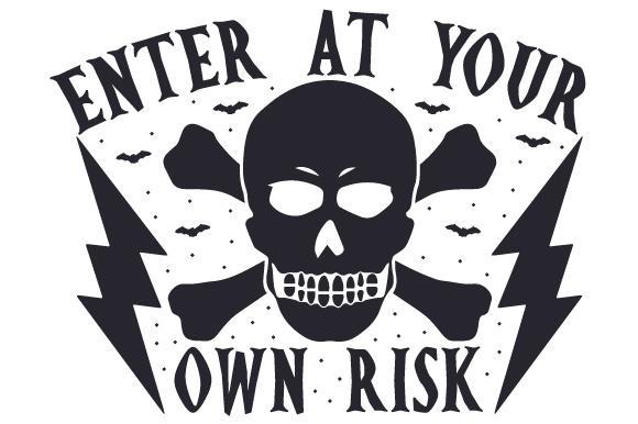
Enter at your own risk! 

You must be 18+ or older
To view this website. 


The information posted below is my own personal opinion. For entertainment purposes only.
I like to post multiple things such as Parody, Entertainment, News, Satire, Events, Editorials, opinions, reviews, photography, music, educational, etc…
I like to inform our community on different things and have fun doing so.
The information posted is dynamic. And may not be accurate.
RockfordScanner@gmail.com for any corrections or updates.
Please do your own research and form your own opinion. First Amendment & Fair Use


what are you looking for


We know times are tough. Tough for you, tough for RS. 
Please take a few seconds and consider donating to RS! 
Every bit helps. It covers the website maintenance, hosting, etc…
All the stuff it takes to run a website. Wished it was free, sadly it is not. 
To keep RS FREE, please help support RS!Donate

It is Christmas time.
The time of positivity & giving!

CLICK HERE:
Send Rockford Scanner A Present
For Christmas!

Every little bit helps!


Winnebago-Boone-McHenry-Ogle-Lee-De Kalb-
Including the cities of Rockford, Belvidere, Crystal Lake,
Algonquin, McHenry, Woodstock, Rochelle, Oregon, Byron, Dixon,
DeKalb, and Sycamore
155 PM CST Sun Jan 7 2024

...WINTER STORM WATCH IN EFFECT FROM TUESDAY MORNING THROUGH LATE
TUESDAY NIGHT...

* WHAT...Heavy wet snow possible. Total snow accumulations in
  excess of 6 inches Tuesday through Tuesday night. Winds could
  gust in excess of 30 mph Tuesday night.

* WHERE...Winnebago, Boone, McHenry, Ogle, Lee, and De Kalb
  Counties.

* WHEN...From Tuesday morning through late Tuesday night.

* IMPACTS...Travel could be very difficult. The hazardous
  conditions could impact the evening commute.

* ADDITIONAL DETAILS...A quick round of snow of 1 to 3 inches
  will precede the period of heavier snowfall by several hours
  Monday night. Snowfall rates in excess of 1 inch per hour are
  possible at times late Tuesday morning into Tuesday evening.

PRECAUTIONARY/PREPAREDNESS ACTIONS...

Monitor the latest forecasts for updates on this situation.
Through Tuesday night...

Key Messages:

- Winter Storm Watch issued for heavy wet snow for Northern 
  Illinois west of the Chicago Metro Tuesday into Tuesday night.

- Snow arrives Monday night. Roughly 6 hour window in which snow 
  rates may briefly exceed 1 inch per hour exists, particularly 
  along and south of I-80 with a likelihood for challenging AM 
  commutes. 

- Brief lull in activity Tuesday morning before more widespread 
  impacts from accumulating wet snow Tuesday and gusty NW winds 
  Tuesday night. Greatest threat for significant impacts remains 
  west of I-55.

The well-advertised winter storm across the central CONUS is now 
beginning to eject eastward out of the Four Corners Region. 
Consensus guidance has remained stead-fast with the forecast for 
several days, albeit with some gradual trends northwestward over 
the past couple days. So while we continue to see wobbles in 
guidance, especially with a NW shift at the end of the 12Z CAM 
guidance, the overall range of ensemble scenarios continues to 
narrow with substantial clustering developing within both the GEFS
and EPS. Messaging of the system remains focused on two distinct 
periods of impacts from snow; The first with a quick but potent 
round of multiple inches of wet snow Monday night and the second 
with a heavy band of wet snow in the northwest CWA centered around
Tuesday afternoon.

Window 1 - Monday night: 

Significant low-level WAA/isentropic ascent and moisture 
transport below impressive mid-level diffluence and the upper jet 
streak will support a period of very strong deep layer ascent 
moving northward through the CWA Monday night. Even through a mid-
level dry layer would typically cause some concern with slowing 
the northward push of precip, the forcing and moisture should 
quickly overwhelm the dry layer and produce a quick transition 
from dry conditions to moderate to potentially heavy snow. Most of
the snow will fall in a 4 to 6 hour window with rates of 1/2 to 1
inch per hour using SLR values of 6-8:1. This results in a 
generalized 2-5" across the CWA, favoring the higher end of the 
range south of I-80. A Winter Weather Advisory will likely be 
needed ahead of a general lull in precip Tuesday morning. 
Expectations are for notable travel impacts during the Tuesday 
morning commute.

Window 2 - Late Tuesday morning into Tuesday evening: 

A dry slot should diminish precip potential to a snow/drizzle mix
or complete changeover to light rain across the southeast half of
the CWA Tuesday morning.

Even with the increased clustering of guidance, the marginal 
thermal profiles mean potential solutions still present a 
significant challenge with pin-pointing the rain/snow line and 
sharp gradient of snow amounts by the afternoon. The latest data 
used in this forecast focuses the surface low track roughly along 
the I-55/57 corridors roughly from near Bloomington to extreme 
northwest Indiana. This places the northwest 1/3 of the CWA in the
favored deformation axis of heavy snow with a very sharp 
rain/snow line somewhere in the far northwestern Chicago metro to 
around La Salle County. The warm profile with a deep isothermal 
layer at or just below freezing will yield a very wet snowfall 
with SLR values under 10:1 through the day. Given these low SLRs 
and higher snowfall rates (in excess of 1"/hr at times), 
significant disruptions in travel are expected. A Winter Storm 
Watch has been issued for areas roughly west of a line from 
McHenry into far southern Lee County. Overall, snowfall totals in 
excess of 6" Tuesday into Tuesday evening are becoming more likely
(70%) in the watch area.

As noted in previous forecast discussions, a rather sharp 
gradient in snowfall amounts is anticipated. The means that even a
<50 mile shift in the low track would result in a forecast change
from little snowfall to warning criteria snowfall for some 
locations in the envelope of forecast scenarios. This area of 
concern lies on the eastern edge of the Winter Storm Watch 
eastward into much of the Chicago metro, so a further eastward 
extension of headlines during this period may be warranted with 
future forecast updates. In other words, there will likely be a 
narrow corridor (i.e. on the order of one county) where forecast 
snowfall amounts drastically change as we close in on Tuesday.

Tuesday night: Snowfall will begin to wane Tuesday evening before
diminishing to some lingering flurries Wednesday morning. The 
absence of a strong arctic high behind the system will limit wind 
impacts Tuesday night, but NW gusts in excess of 30 mph may result
in some sporadic tree and powerline damage due to higher snowload
from the wet snow.


We also accept the following donations:
———> Estates, Houses, Money, Vehicles, Land, Stock, CD’s, etc… <———

Contact us at: RockfordScanner.com
Thank You in advance for your donation!


If you like our page, please show your gratitude! 

donate, donation, donated, sponsor, sponsorship, best, top,


Rockford Scanner, Rockford News, Rockford Crime, RockfordIL, Rockford Illinois, Illinois
Rockford Scanner

Rockford Scanner ,Frequently Asked Questions, FAQ, Rockford Scanner, Rockford News, Rockford Crime, RockfordIL, Rockford Illinois, Illinois
FAQ

Rockford Scanner, sponsor, sponsorship, donate, donation, donated, Rockford Scanner, Rockford News, Rockford Crime, RockfordIL, Rockford Illinois, Illinois
Sponsors

See it, Snap it, Send it
SEE IT: See a scene or something of interest 
SNAP IT: Pull our your camera and film
SEND IT: RockfordScanner@Gmail.com


contest, rockford, win, winner, rockford contest, photography contest, Rockford Scanner, Rockford News, Rockford Crime, RockfordIL, Rockford Illinois, Illinois
Contest

Feeling lucky?
FREE entry, for your chance to win on RockfordScanner.com
https://rockfordscanner.com/contest/


Rickie Traeger, rick, ricky, ricki, rickie, treager, trayger, website owner, rs, rockford scanner, cowboy, hot, sexy, beautiful, dilf, news, famous, celeb, cowboy hat, real cowboy, web designer, website, site, web, own, admin, smile, illinois, il, ill, rockford, chicago, wisconsin, proud, usa, usa proud, american,
Rickie Traeger:  Rickie Traeger.com

Police Radio Encryption

chat rooms
Rockford Scanner Chat Rooms

Please take a few seconds and follow us,
On our social media.
Facebook, Youtube, X
If you would like to get
Near real-time notifications, when we post.
Make sure you hit that push notification button above!


REMEMBER: We post everything on our website first,
Before posting it to social media. So, check our website here first.

Click on that annoying button on top, to SUBSCRIBE!
And you will get almost real time notifications, FREE!


Submit Tip
Contact Us : Rockford Scanner

RockfordScanner.com is not affiliated with any police, fire, or medical departments.
However, if you would like us to relay some information to any department.
We can be that third-party and relay your information and keep you anonymous.
CLICK HERE TO CONTACT RS


Checkout one of the best
Police scanner’s on the market!

SDS200 Uniden Police Scanner
SDS200 Uniden Police Scanner!

If you have any information:
RockfordScanner@gmail.com

Rockford Police Number
Non-emergency numbers


If you see an error.
Please let us know right away!
Some content is assisted with AI tools.
We strive for accuracy.

*** A simple anonymous email saying ***
“Hey that is not what happened,
But this IS” what happened…”
Email us at
RockfordScanner@gmail.com

Simple communication and transparency,
Would eliminate any misinformation or exaggerations.


Our content is for entertainment purposes only.
Informative entertainment.

  • CLICK HERE TO READ OUR DISCLAIMER & TERMS
  • All the information posted is our own personal opinions.
  • Our opinions on what allegedly may possibly have happened.
  • Based on the information that was currently provided to us, at the time of posting it.
  • We strongly recommend you doing your own research and forming your own opinion.
  • We are protected by the 1st Amendment and also Fair Use.
  • Everyone is innocent, until proven guilty in a court of law.
  • We cannot guarantee the accuracy of our content.
  • Information is very dynamic
  • The information posted is my own personal opinion.
  • For entertainment purposes only.
  • We post multiple things such as;
    Parody, Entertainment, News, Satire, Events, Editorials,
    Opinions, reviews, comedy, controversial, photography,
    Pensée, aphorism, music, educational, etc…
  • You must read and agree to our terms.
  • If you do not agree with our terms, please leave now.
  • Any corrections, please contact us right away.
    RockfordScanner@gmail.com

CLICK HERE TO READ OUR
DISCLAIMER & TERMS

rockford scanner disclaimer entertainment purposes only

Rockford Scanner Blog Opinion