Rockford Scanner

Email: RockfordScanner@gmail.com
Current information that has been provided to us

NWS :
Monitoring a heavy rain and flash flood potential late tonight into Wednesday.
We continue monitor severe weather and flooding threats tonight into Wednesday.
A good deal of uncertainty remains, particularly with the severe threat on Wednesday.
National Weather Service Chicago/Romeoville, IL
.MESOSCALE DISCUSSION…
.SHORT TERM…
Tonight Through Wednesday…
Key Forecast Messages:
* Threat for training thunderstorms and an attendant flash flood
threat late tonight into Wednesday morning.
* A heavy rain threat is likely to persist through at least early
afternoon on Wednesday.
The surface cold front is likely to set up somewhere near U.S. 24
(over a our far south) into tonight. After a dry period for most
of if not the rest of the evening after any lingering convection
dissipates, forecast guidance then forecasts the ramp-up of a
southwesterly low-level jet late tonight into Wednesday morning in
advance of an approaching convectively enhanced disturbance
moving across IA.
The induction of strong warm air advection along this low-level
jet and to the north of the surface boundary is likely to support
a narrow corridor favorable for elevated thunderstorm development
somewhere right across northern Illinois and far northwest
Indiana. While the exact placement of these storms continues to be
a bit unclear at this time, there is concern for a heavy rain and
localized flash flood threat into late tonight into Wednesday as
an easterly storm movement will parallel the front and the 500 mb
flow, potentially leading to training storms.
We will have to monitor this threat closely as its possible these
storms could occur over, or near the Chicago metro area. If the
greater threat area can be honed in on later this evening,
particularly if it’s expected to include Chicago and the
surrounding heart of the metro area, we may be able to target a
Flood Watch. However, will not be issuing a watch this afternoon.
Deeper moisture in the 850 mb to 700 mb layer may be a bit
lacking for a higher end flash flooding threat and greater
confidence in watch issuance.
The convectively enhanced impulse over IA will translate eastward
across northern IL during the late morning and afternoon hours of
Wednesday. This is expected to drive a region of more widespread
showers and some storms, with a continued heavy rain and flood
threat through early afternoon (level 2 of 4/slight risk ERO from
WPC). Along with the continued heavy rain and flooding threat, we
will also have to continue to monitor the threat for severe
storms, particularly south of I-80 into Wednesday afternoon/evening
as the potential exists for the backbuilding of thunderstorms
back into the unstable airmass building into from the west.
Uncertainty exists with how exactly this may unfold, but
it appears winds off the surface will veer west-southwesterly in
the wake of the impulse. This would likely support continued warm
air advection, and the eastward advance of a very unstable airmass
from the west amidst 30-45 kt of effective bulk shear. On the
other hand, the messy convective evolution prior to that and
clouds and rain limiting more appreciable destabilization does
once again greatly increase uncertainty and lower confidence in
how things will evolve into early Wednesday evening.
KJB/Castro
&&
.LONG TERM…
Issued at 330 PM CDT Tue Jul 11 2023
Wednesday night through Tuesday…
Quite a bit of uncertainty on the forecast in the extended given
implications on frontal positions and timing of individual
shortwaves in west-northwest flow. The southern Great Lakes region
will still be in under shortwave troughing, thus some scattered
showers and storms will likely continue. A stronger upper jet core
will approach later in the evening and overnight, and a
corresponding 850 mb backing low level jet in response will maintain
forcing for additional showers and thunderstorms.
The main upper low will be positioned across central Canada. The
southern Great Lakes region will be still under subtle northwest
flow. Some modest instability will build under dewpoints in the
upper 60s, and with some weak forcing any widely scattered showers
or storms would be favored in the afternoon to early evening. At
this time we do not anticipate too much coverage given that the
effective surface front should be south of our region. Deep layer
shear of 35-40 kt would support some storm organization, but again
this is currently favored central Illinois southward.
The upper pattern remains unchanged through the remainder of the
week. It will remain somewhat moist (dewpoints in the upper 60s).
A slightly more organized front will arrive later Friday into
Friday night which would be a favored timed for showers and
storms. Mid level lapse rates are somewhat muted, thus the severe
threat does not look very high.
The upper low will creep closer to the Great Lakes this weekend.
There don’t appear to be any real organized systems, just some
diurnally favored isolated to widely scattered rain chances for now
offered by the National Blend of Models. Temperatures appear to be
seasonal in the mid 80s with modest levels of humidity.
Stay tuned for forecast updates!

CLICK HERE TO SUPPORT OUR WORK!
Thank you in advance for your donation!

SUPPORT ROCKFORD SCANNER
Thank you in advance for your donation!
See it, Snap it, Send it
SEE IT: See a scene or something of interest
SNAP IT: Pull our your camera and film
SEND IT: RockfordScanner@Gmail.com
Checkout one of the best
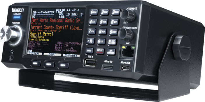
Police scanner on the market!

If you see an error.
Please let us know right away!
We strive for accuracy.
*** A simple anonymous email saying ***
Hey that is not what happened.
But this “IS” what happened…
Email us at
RockfordScanner@gmail.com
Simple communication and transparency,
Would eliminate any misinformation or exaggerations.
Our content is for entertainment purposes only.
Informative entertainment.
All the information posted is our own personal opinions.
Our opinions on what allegedly may have possibly have happened.
Based on the information that was currently provided to us, at the time of posting it.
We strongly recommend you doing your own research, and forming your own opinion.
We are protected by the 1st amendment.
Everyone is innocent, until proven guilty in a court of law.
We can not guarantee the accuracy of our content.
Information is very dynamic. You must read and agree to our terms.
If you do not agree with our terms, please leave now.
If you know of any corrections, please contact us right away.
RockfordScanner@gmail.com
CLICK HERE TO READ OUR
DISCLAIMER & TERMS


