Rockford Scanner
News, Editorials, Events, Paranormal,
Sports, Weather, Letters to the Editor, Reviews, Opinions,
Police Scanner, Advertisements, Humor, Jokes, Satire, Parody,
Whatever we feel like posting about…
We strongly recommend you doing your own research,
And forming your own opinions.


Facts: Simple communication and transparency
WOULD eliminate any misinformation or exaggerations
Fitness Equipment by Power Systems
Our opinion on what allegedly may have happened,
Based on the information that has currently been provided to us.
Any Errors/Corrections, Please Contact Us: RockfordScanner@gmail.com
.UPDATE...
Issued at 1043 AM CDT Fri Mar 31 2023

A well-defined lead mid-level wave entering southwest MO will
continue to muddle the forecast evolution this afternoon. A small
70kt jet streak associated with this wave has started to show more
coverage of convection, albeit still elevated, between Kansas
City and Springfield, MO. Timing of the wave and developing
convection is progged to arrive into our southwest CWA as early as
19Z-20Z. The main questions with this potential round of storms
include:

1) Does the SW MO convection grow upscale?
2) Will the convection have enough time to become surface-based?

Obs trends combined with recent CAM guidance do support at least
some upscale growth as impressive mid/upper forcing continue to
erode an existing EML with northeast extent. A well-organized
convective complex may struggle to fully materialize, which would
increase some concern for the potential of more discrete activity
into our area. This leads to the question of surface-based
convection potential. In the wake of pre-dawn convection over
Illinois, the EML has suppressed most mid to upper-level cloud
cover. Some low-level clearing has been more aggressive than
initially expected, with surface temps already around 60F. Surface
dew points remain a little more questionable, with mid 50s dew
points to the southwest requiring at least some assistance with
mixing down higher mixing ratios in the 800-900hPa layer. With all
that said, there is increasing concern that low-level profiles
will become more favorable for surface-based convection as far
north as the Illinois River and possibly into the southern Chicago
metro by 20-21Z/3-4pm. All hazards will remain on the table if
convection does become surface-based, including supercells capable
of very large hail, strong winds, and possibly a strong tornado.
OVerall, the concern window is highest 3-5pm.

Assessment continues with the second wave of convection along the
cold front early to mid-evening (6-10pm). The impressive dynamics
will support a significant severe threat owing to rapid
replenishment of the upstream airmass even in the wake of
potential convection mid-afternoon.

Kluber

&&

.SHORT TERM...
Issued at 334 AM CDT Fri Mar 31 2023

Through Saturday...

Complex weather scenario playing out over the next 12-18 hours
with an all-hazards severe weather risk (including the potential
for damaging winds (significant severe gusts in excess of 75 mph
are on the table), a few to even several tornadoes, and damaging
hail. However, uncertainty in how things play out, including who
has the locally highest severe risk and ultimate magnitude and
coverage has gotten a little more nebulous/muddied based on
overnight guidance.

In the very near term, elevated showers and thunderstorms will
continue to track east across the region this morning in
association with a lead wing of isentropic ascent acting upon a
plume of steepened mid-level laps rates. Given effective inflow
bases above 1-1.5 km, deep layer shear is pretty limited (less
than 20 kts), so we're not anticipating much of a severe risk with
this activity although have seen depths occasionally increasing
enough to suggest penny to perhaps nickel hail in the most robust
cores. Expecting that coverage will gradually wane through the
morning hours.

The main change to this afternoon's forecast in overnight guidance
has been to more strongly suggest a lead impulse firing an earlier
round of convection across parts of Missouri before spreading
north and east into our region. Conceptually, this activity looks
like it would be forced on the nose of an intensifying 500 mb jet
streak near 70 kts which is just now spreading east across parts
of Oklahoma. Noting greatly increasing upper divergence into our
region early this afternoon as a result, and this seems like it'll
easily catch up to a renewed reservoir of a pretty much untouched
EML plume characterized by very steep 500-700 mb lapse rates
nearing 9 C/km. Given the intense nature of jet forcing and how
steep the mid-level lapse rate plume is forecast to be, can't
really see how things don't rapidly convect into parts of the
forecast area early-mid afternoon (although a quieter early-mid
afternoon solution is still advertised by a handful of hires
output). Currently, best guess is this initial/lead activity gets
close to or into our forecast area around 1-2 PM or so before
developing north and eastward.

Depending on how quickly this lead activity develops, parts of it
may remain just a bit elevated (initially), but any southwestward
development, or tardier progression will greatly increase the
potential for cells to become rooted at the surface as dewpoints
crawl upwards and MLCINH decreases. Kinematic profiles get very
concerning very quickly towards mid to late afternoon,
particularly across the southwestern half of our forecast area
where, if convection is ongoing, discrete or semi-discrete
supercells have the potential to become surface based with an
attendant increasing tornado risk (talking possible sig-tor
territory given the parameter space) with large, looping
hodographs noted. All modes of severe weather would be possible,
seemingly highest in a corridor south and west of Rockford to
Joliet to Watseka in the vicinity of the surging 60 degree
isodrosotherm although the tornado risk could very well extend
farther north and east depending on just how quickly the near-
surface manages to destabilize (another wild-card present).

If this initial activity materializes, it remains unclear just how
much of a deleterious impact it will have on the thermodynamic and
kinematic profiles ahead of the incoming cold front. Given how
strong the low-level mass response is, there's a possibility that
the airmass recovers just enough in the 2-3 hours between waves to
support a secondary severe window across pretty much all of the
forecast area although a pristine/untouched airmass would not
exist across the full breadth of our CWA. Increasing large scale
forcing for ascent along the surging front and associated
occlusion looks to result in fairly quick growth in a line or
several LEWPS, entering our I-39 locales after about 6-7 PM before
racing north and eastward at about 65 mph. The HRRR is certainly
aggressively indicating our airmass will have no trouble
supporting a renewed severe threat with this evening frontal
convection and is now formally resolving sig-severe wind gusts
through much of the region. QLCS mesovortexgenesis would also be
on the table here given incredible low-level shear profiles
resulting in an attendant embedded tornado threat.

All of this to say that the table is certainly set for a
potentially significant severe weather episode across parts of
our area, but lingering uncertainties exist particularly owing to
the potential for a lead area convection early-mid afternoon. The
end result of all of this: continue to monitor the forecast today
for updates!

In addition to the convection potential, a non-thunderstorm wind
potential exists, as early as this afternoon as deeper mixing is
realized into the core of the robust LLJ. Best chance for more
widespread strong non-thunderstorm gusts will be in the developing
cold advective regime late tonight as low-level lapse rates
steepen. Am even seeing a potential for a brief window of 55 mph
gusts across the entire region initially (up to the WI state
line), although confidence in this was too low to indicate in the
grids at this time. Highest confidence for gusts over 45 mph as
near and south of I-80, and have issued a Wind Advisory to cover
both the WAA-driven southwesterlies and CAA-driven westerlies
there for late this afternoon through Saturday morning. Based on
the depth of the mixed layer (up near 850 mb) and incredible
pressure rises (12-15 mb/3 hour advertised), am still somewhat
concerned there may be a brief window for damaging gusts
approaching 60 mph in a brief "pop" late tonight as the main CAA-
push arrives.

Additional area of precipitation will sweep through the area on
Saturday morning. Profiles are cold enough to support a changeover
to all snow in our far north, although temperatures expected to
remain at or above freezing for the most part limiting impacts. If
things were colder, would be more concerned with a squall/snow
squall potential given the lingering strong winds through the PBL.

Carlaw

&&

.LONG TERM...
Issued at 235 AM CDT Fri Mar 31 2023

Saturday night through Thursday...

Primary forecast concern is the potential for another period of
severe thunderstorms Tuesday into Wednesday along with another
period of possible wind advisory level winds.

A frontal boundary will become stationary across the southern cwa,
or just south of the area Monday night with chance of showers and
thunderstorms returning Monday night. This frontal boundary is
expected to lift back north as a warm front on Tuesday as low
pressure deepens moving from the central Plains to the upper
midwest. A strong cold front is expected to move across the area
Tuesday night and this time period would be most favored for the
potential for severe weather as shown in the days 4-8 outlook from
SPC. Strong westerly winds are then possible Wednesday, possibly
into advisory level. cms
As much as we hate asking for donations.
Sadly, it does cost money to run RS.
Dedicated server, Domain, Maintenance, Time, etc…
Every penny helps!
Donate via debit or credit card:
CLICK HERE
Thank you in advance for your donation!
Officials have not yet released any information:
- To confirm anything (Nothing is confirmed),
- On the incident (What happened?),
- Possible alleged suspects, (Who may be involved?),
- If there is a possible threat to the community (Community in danger?),
- Who to possibly be on the lookout for, (Who to be on the lookout for?),
- If they do release information, we will update this.
If there are no updates, officials have not released any information that we are aware of.
Rockford Scanner
See it, Snap it, Send it
- SEE IT: See a scene or something of interest
- SNAP IT: Pull our your camera and film
- SEND IT: RockfordScanner@Gmail.com
Examples of
Rockford Scanner Fan Submissions


CLICK HERE TO DONATE
Thank you in advance for your donation!

Visit our sponsors:
CLICK HERE
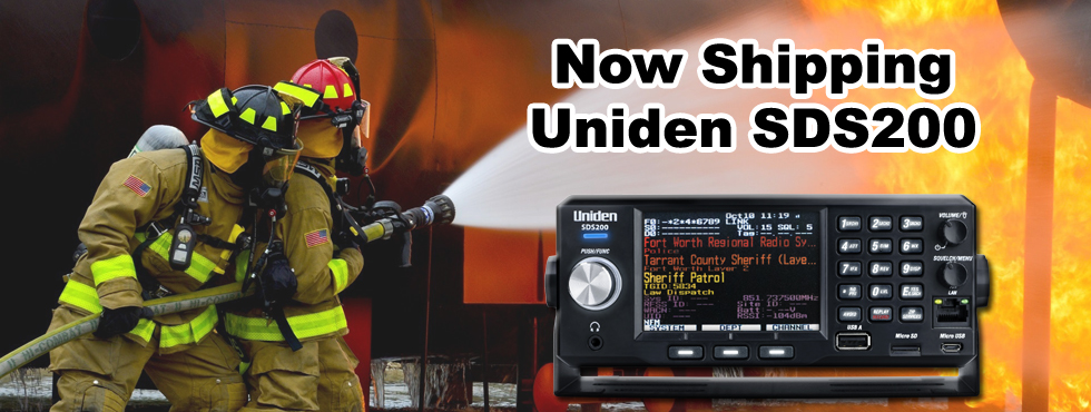
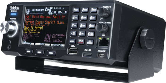
Checkout one of the best
Police scanner on the market!

 Our personal opinions on various topics.
Rockford Scanner
PARANORMAL FILES!

Disclaimer:

- Our content is for entertainment purposes only.
- Informative entertainment.
- All the information posted is our own personal opinions.
- Our opinions on what allegedly may have possibly have happened.
Based on the information that was currently provided to us, at the time of posting it. - We strongly recommend you doing your own research, and forming your own opinion.
- We are protected by the 1st amendment.
- Everyone is innocent, until proven guilty in a court of law.
- We can not guarantee the accuracy of our content.
Information is very dynamic and may change. - If you know of any corrections, please contact us right away.
RockfordScanner@gmail.com - You must read and agree to our terms.
If you do not agree with our terms, please leave now.

Our information is for entertainment purposes only. Because of this, We can not guarantee the accuracy of our information. If you know of any errors, please contact us at RockfordScanner@gmail.com and please provide us with the proof of the correction. We strive for accuracy. But, the information is always dynamic and changes often with our type of content. Because of this, We do apologize ahead of time if there are any errors. So, Please let us know of any updates or errors! We are protected under the first amendment.
Disclaimer and Terms: CLICK HERE


