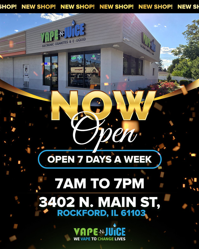
Vape N Juice Rockford & Loves Park, IL Multiple convenient locations Great variety of vape juices, devices, coils & more Shop local – Vape happy!
Lask Exterior Solutions www.laskexteriorsolutions.com Trusted Roofing • Siding • Windows • Gutter Systems Serving Rockford & Northern Illinois
Support Rockford Scanner
Thank you to everyone who subscribes and donates! Your support keeps real-time local news free, factual, and independent for 19,200+ Winnebago County residents every day.
ROCKFORD – Beginning Wednesday April 8, the Water Division will be repairing the water service in the 2200 block of Broadway. Broadway will be closed between 18th St and 19th St to all traffic.
Proper traffic controls and detours will be in place and citizens are encouraged to use an alternate route. The driving public is to use extreme caution when near work zone. If water is shut off for repairs, residents in the area will be notified through information hung on their front door.
Work is expected to last up to two to four business (2-4) days, weather permitting.
Rockford –Effective Thursday April 9th, contractors for the City of Rockford will close the northbound curb lane starting in the 3100 block of N Alpine Rd just north of Burningtree Dr. This closure is needed for storm water inlet repairs. Subject to weather, the work is anticipated to be complete by the end of business Friday, April 10th, 2026.
Traffic controls will be in place. Citizens who must drive through this area are encouraged to find an alternate route if possible. If you must drive through the work zone, citizens are urged to use extreme caution.
Rockford –Effective Wednesday April 8th, contractors for the City of Rockford will close the eastbound curb lane starting in the 4500 block of Springcreek Rd . This closure is needed for storm water inlet repairs. Subject to weather, the work is anticipated to be complete by the end of business Friday, April 10th, 2026. Traffic controls will be in place. Citizens who must drive through this area are encouraged to find an alternate route if possible. If you must drive through the work zone, citizens are urged to use extreme caution.
Rockford –Effective Wednesday April 8th, contractors for the City of Rockford will close the eastbound curb lane starting in the 3800 block of Springcreek Rd . This closure is needed for storm water inlet repairs. Subject to weather, the work is anticipated to be complete by the end of business Friday, April 10th, 2026.
Traffic controls will be in place. Citizens who must drive through this area are encouraged to find an alternate route if possible. If you must drive through the work zone, citizens are urged to use extreme caution.
ROCKFORD – Beginning Wednesday April 8, the Water Division will be repairing the water service in the 1300 block of School St. School St will be closed between Furman St and N Hinkley Ave to all traffic. Proper traffic controls and detours will be in place and citizens are encouraged to use an alternate route. The driving public is to use extreme caution when near work zone. If water is shut off for repairs, residents in the area will be notified through information hung on their front door. Work is expected to last up to two to four business (2-4) days, weather permitting.
City Council Advances Major Investments in Growth, Infrastructure, and Community Services
The Rockford City Council approved a series of significant measures during its most recent meeting, reflecting ongoing efforts to guide long-term development, improve infrastructure, and enhance community services across the City of Rockford.
Council members approved the 2040 Future Land Use Plan, a data-driven framework designed to guide development decisions over the next 15 years. The plan aligns with the City’s broader comprehensive strategy and emphasizes balanced growth, expanded housing options, economic development, and preservation of neighborhood character. Officials indicate the plan will play a key role in shaping infrastructure investments and land-use decisions moving forward.
Investment in Youth and Arts Programs
The Council also approved a $100,000 funding agreement over two years with Phantom Regiment. The funding follows the organization’s recent acquisition of property on International Drive and supports expanded programming in music education, including drumming and color guard opportunities for students of varying skill levels. The initiative is expected to strengthen both youth engagement and local economic activity through events and partnerships.
Major Infrastructure Improvements
A substantial portion of the meeting focused on infrastructure upgrades:
A $9.69 million contract was approved for improvements along 11th Street, including roadway reconstruction, multi-use paths, sidewalks, lighting, landscaping, and utility upgrades.
A $593,000 engineering agreement with Fehr Graham will support construction services for the same corridor project.
A $387,373 contract was awarded to Rock Road Companies for resurfacing and repairs near the downtown expansion area.
These projects are part of the City’s multi-year Capital Improvement Program and aim to enhance safety, accessibility, and long-term infrastructure reliability.
Land Acquisition and Transportation Projects
The Council approved multiple agreements to support future transportation and pathway projects:
A $120,000 agreement with Hanson Professional Services Inc for land acquisition tied to the Highcrest Multi-Use Path project.
A $67,000 agreement for land acquisition related to Phase 2 of the Madison Street Corridor improvements.
Both projects involve easements, appraisals, and coordination necessary for anticipated construction phases beginning as early as summer 2026.
Facility Upgrades and Public Works
Additional approvals included:
A $1.03 million contract for roof replacement and HVAC upgrades at 214 North Church Street, supporting future phases of the Rockford Family Peace Center project.
A unit-price contract with Zimmer & Francescon for ongoing storm drain and manhole maintenance, supporting over 30,000 roadway structures citywide.
Environmental and Redevelopment Efforts
The City approved a $125,000 agreement with Fehr Graham Engineering & Environmental to conduct environmental assessments at brownfield sites. These efforts are intended to prepare properties for redevelopment and potential federal funding opportunities through the EPA.
Homelessness Assistance Funding
Council members accepted a $132,000 grant from Community Solutions to support individuals experiencing unsheltered homelessness. The program will provide flexible assistance, including rent support, utility deposits, and other aid, with a focus on individuals over age 55 and those with limited income.
Technology Modernization
To improve communication and public service, the City approved a $938,864 contract with RingCentral to replace its legacy phone system. The new cloud-based platform will consolidate communication services and is projected to reduce annual costs while improving responsiveness to residents.
Community Impact
These approvals reflect a broad strategy focused on long-term growth, infrastructure modernization, economic development, and community support services. City officials continue to emphasize data-driven planning and targeted investment as Rockford moves forward with multi-year improvement initiatives.
Another Shooting Victim, Rockford PD Preach About Transparency, But Remain SILENT
UPDATE: Reports are saying the victim is allegedly dead.
A reported shooting incident occurred around 12:20 PM on April 5, 2026, in the 5900 block of Shelford Lane in Rockford, Illinois. Early reports indicate that a victim was involved, though the condition of the individual has not been officially confirmed at this time.
Emergency responders, including Rockford Fire and paramedics, were dispatched to the scene. As of now, there has been no detailed public statement released by the Rockford Police Department regarding the circumstances, suspect information, or severity of injuries.
At this time, the information available remains limited. No verified details have been released regarding:
The identity of the victim
The extent of injuries
Whether any suspects are in custody
The events leading up to the incident
Public Information Gap and Transparency Concerns
The lack of immediate official communication continues to create challenges for public awareness and accurate reporting. When timely and verified information is not made available, it can lead to speculation, confusion, and the spread of misinformation within the community.
Clear, factual communication from official sources plays a critical role in:
Maintaining public trust
Ensuring community safety awareness
Reducing rumors and false narratives
What We Know vs. What Is Unconfirmed
Confirmed:
Location: 5900 block of Shelford Lane, Rockford
Time: Approximately 12:20 PM
Nature: Reported shooting with a victim
Emergency response dispatched
Unconfirmed / Not Yet Released:
Victim condition
Suspect information
Motive or circumstances
This remains a developing situation. Updates will be provided as soon as verified information becomes available through official channels or confirmed sources.
🚨 Alleged Violent Assault Reported in Rockford Overnight
A serious incident is being reported involving a female victim who sought help at a local gas station on West Riverside Boulevard. According to initial reports, the woman stated she had been maced at another location prior to arriving at the business.
Unconfirmed information further indicates the situation may have involved a physical assault and a possible sexual assault. At this time, these details have not been officially confirmed by law enforcement.
The incident is believed to have occurred overnight, approximately eight hours prior to this report being published.
At the time of writing, the Rockford Police Department has not released an official statement regarding this incident. As with all developing situations, information can evolve rapidly as investigators gather facts and verify details.
Out of an abundance of caution and responsibility to the community, it is important to emphasize that all information beyond confirmed official statements should be treated as preliminary.
Transparency and timely communication from official sources play a critical role in reducing misinformation and ensuring public trust, especially in incidents of this nature.
If you have any information related to this incident, you are encouraged to contact local authorities.
More updates will be provided as soon as verified information becomes available.
Early Saturday morning, crews from the Marengo Fire & Rescue Districts responded to a unique rescue after a horse was found stranded in floodwaters along Coon Creek following overnight storms.
Arriving crews located the animal roughly 600 feet from shore, surrounded by fast-moving water as the creek had overflowed its banks. The horse had taken footing on a small peninsula, which limited direct access.
The strong current and depth of the creek, estimated at approximately 15 feet, prevented crews from simply bringing the animal straight across. An initial team utilized a boat to reach the horse, while additional personnel and a veterinarian worked from shore and nearby access points to support the operation. The boat crew then transported the veterinarian across the creek to the animal, where care was initiated, including administering medication and addressing the effects of cold water exposure, which was suffering from significant hypothermia, as crews continued preparing for the next phase of the rescue.
As the incident expanded, additional resources were requested through the Mutual Aid Box Alarm System, bringing specialized swiftwater technicians and additional manpower to the scene. With coordinated efforts from all personnel, the horse was gradually guided across the creek and brought to shore. Nearly two dozen responders then worked together to move the animal from the water’s edge to the roadway, where it was loaded into a trailer and transported for continued veterinary care.
We would like to extend a sincere thank you to Dr. Nicky Wessel with Cutting Edge Equine Veterinary Services for her critical role in caring for the animal throughout the rescue. We also thank the Wisconsin Large Animal Emergency Response Technical Response Team, the many agencies that responded through the Mutual Aid Box Alarm System, and the dispatchers who coordinated the response and supported operations throughout the incident.'
In 2024, the first year of our Residential Tax Rebate Program, Rockford saw 131 housing units under construction - the highest levels since 2007. In 2025, that number grew again to 161 units, including 91 single-family homes, along with new duplexes and multi-family developments across the city. In the 10 years before the program, the city averaged less than 20 single-family homes per year.
To keep that momentum going, the City has approved a new three-year Tax Rebate Program for newly built residential construction. Eligible single-family, townhome, two-family, three-family and multi-family projects in the City of Rockford and RPS 205 district can receive a three-year property tax rebate for the participating taxing bodies.
Why does this matter? Because new housing strengthens neighborhoods, supports job growth, increases property values and helps ensure families have more housing choices at a time when inventory remains historically low.
In addition to the rebate, eligible projects will also have building permit, plan review, inspection, water main connection and water meter connection fees waived. This is about growth, stability, and investing in Rockford’s future, and it’s already delivering results.
MABAS 2nd Box Alarm Activated for Structure Fire in Rural Winnebago County
LINDENWOOD, IL — April 4, 2026 (12:50 PM)
Emergency crews are actively responding to a reported structure fire in the 16000 block of East Gibson Road in rural Lindenwood, located just south of Rockford.
According to initial dispatch information, a MABAS 2nd Box Alarm has been struck, prompting a large-scale mutual aid response from multiple fire departments across Winnebago County and surrounding areas.
This level of alarm typically indicates a significant fire requiring additional manpower, water supply resources, and specialized equipment.
Fire agencies from across the region have been requested to assist, suggesting that crews may be dealing with a rapidly evolving situation or challenges related to access, water supply, or fire conditions.
At this time, the extent of the fire, potential injuries, and cause remain unknown.
No official confirmation has been released regarding occupants or structures involved.
Residents in the area may notice a heavy presence of emergency vehicles and are urged to avoid the scene to allow first responders clear access.
This is a developing situation.
Updates will be provided as soon as confirmed information becomes available from official sources.
I have been told that there was an alleged homicide on Rockford's East side yesterday morning.
Initial reports said numerous Rockford PD officers, swarmed the area and began talking to neighbors.
Asking for footage and witnesses.
As you know,
Rockford PD has hidden approx. 47 alleged murders
from our community. To push the crime is down, and to discredit RS.
It happened this morning approx. in the Parmelee and 21st area.
Sadly, Rockford Police still choose to encrypt and be non-transparent,
About another alleged violent crime.
As you can clearly see, there is crime scene tape up.
Rockford PD are notorious liars these days since encrypting....
Do good guys lie to their community members?
The presence of clearly visible barricades and police tape at the scene raises reasonable and legitimate questions that deserve thoughtful consideration.
WHY the barricades, Why the crime scene tape up,
For an "UNFOUNDED" incident?
If the incident was ultimately determined to be unfounded, it is appropriate to ask why such scene-control measures were implemented in the first place. Barricades and police tape are not typically deployed without a perceived need to secure or preserve an area.
Additionally, it is fair to examine the timeline. Standard protocol would suggest that responding officers conduct an initial assessment within minutes of arrival.
This includes determining whether there is a victim, evidence of a crime, or any immediate threat to public safety. If no victim or evidence was identified early on, it invites further inquiry into why the situation escalated to the point of requesting additional resources.
The logistical aspect also warrants attention. The process of coordinating with a street department, mobilizing personnel, retrieving barricades, transporting them to the scene, and setting them up is not instantaneous.
It requires time, communication, and intentional decision-making. These actions suggest that, at some stage, the situation was treated with a level of seriousness inconsistent with a call later described as unfounded.
Taken together, these observable actions scene security, resource allocation, and interdepartmental coordination indicate that the initial response was based on information or circumstances that warranted caution. This does not inherently imply wrongdoing, but it does underscore the importance of clear, transparent communication from agencies such as the Rockford Police Department.
Public trust is strengthened when information is shared accurately and consistently. When there appears to be a disconnect between observable actions and official statements, it is natural for the community to seek clarification. Thoughtful questions in these situations are not accusations; they are part of a healthy and informed public dialogue.
In the end:
WHY the barricades?
Why the crime scene tape up?
For an "UNFOUNDED" incident...
Do you trust those that preach they are transparent,
But CHOOSE to remain ENCRYPTED?
Rockford Police Call Log For The Incident
Rockford, IL Authorities are actively investigating a reported death in the Rockford area, though official details remain limited at this time.
The Rockford Police Department has not yet released a formal statement confirming key aspects of the incident, including the exact circumstances, location specifics, or whether any suspects have been identified.
All reports are from alleged witnesses and neighbors. Sadly, Rockford PD chooses encryption and haven't released any details.
As the investigation continues, more information is expected to be released by authorities. Well, I should re-phrase that.... Hopefully, police are HONEST and TRANSPARENT.......
Updates will be provided once they are provided to us.
Anyone who may have information related to this incident is encouraged to contact:
This email address is being protected from spambots. You need JavaScript enabled to view it.
Photos by RS sources RM and BH
Note: Rockford PD call logs show it as a shooting. Several said this was an alleged homicide. 1 report that said it may have been a swatting incident. Rockford Police choose to remain encrypted and silent. Food for thought.
Clear, consistent communication and genuine transparency are essential foundations of public trust. When accurate information is shared in a timely and straightforward manner, it significantly reduces the risk of misinformation, speculation, and unnecessary exaggeration within the community.
It is therefore critically important for law enforcement agencies to uphold a standard of openness and honesty. Transparency is not simply a principle to be stated, but one that must be actively demonstrated through actions. When communication channels are limited, restricted, or replaced with silence, it creates an environment where uncertainty naturally leads to assumptions.
By contrast, even basic, factual updates provided to the public can serve as a powerful tool to maintain clarity, reinforce credibility, and prevent the spread of false narratives. A commitment to transparent communication does not weaken authority; it strengthens public confidence and fosters a more informed and cooperative community.
In its simplest form, transparency is not complicated. Clear information, delivered honestly and consistently, is one of the most effective ways to eliminate confusion and ensure the public remains accurately informed.
🚨 Community Safety, Accountability, and Respect for Expertise
My objective is simple and sincere: to continually evolve into a more informed, disciplined, and credible voice for the community I serve. Growth requires humility, intellectual honesty, and the willingness to learn from those who dedicate their lives to excellence.
📚 I hold deep respect for institutions such as the National Weather Service, the Storm Prediction Center, and the National Oceanic and Atmospheric Administration. These professionals analyze complex atmospheric data, issue warnings, and protect millions of lives through science, precision, and integrity.
🎯 It is essential that proper credit remains with those who generate the data and make the critical decisions. Public trust is strengthened when transparency and attribution are upheld without exception.
⚠️ A Question of Safety Over Cost
At the core of this discussion lies a fundamental question: Are we prioritizing public safety, or financial efficiency?
If there is a perspective I have not considered, I openly invite thoughtful, evidence-based discussion. Intellectual growth is built on dialogue, not division.
🌪️ Tornado Sirens: A Critical Public Safety Concern
Living within close proximity to a modern tornado siren has provided direct, real-world observation. The design improvements, particularly rotational coverage, are commendable. However, one critical issue remains:
🔊 Audibility
Older mechanical sirens, such as the widely used Federal Signal Thunderbolt 1000T, were engineered to produce sound levels often exceeding 120 to 130 decibels at close range. Their piercing tone was unmistakable, penetrating structures and immediately commanding attention.
By comparison, many newer electronic sirens, while technologically advanced, often operate with more distributed sound patterns that can result in reduced perceived loudness indoors, especially in residential environments.
⚖️ The tradeoff becomes clear:
Older systems prioritized raw acoustic power Newer systems prioritize coverage and flexibility
Both have merit. But effectiveness must always be measured by one standard: Can people clearly hear the warning when it matters most?
🌩️ A Real-World Context
During the April 27 2011 Super Outbreak, one of the most devastating tornado events in United States history, outdoor warning systems played a critical role in alerting populations across multiple states.
However, research and after-action reports consistently reinforce an important truth: 📊 No siren system alone is sufficient
The National Weather Service emphasizes that tornado sirens are designed primarily for outdoor warning purposes, not indoor notification. This is why layered warning systems, including NOAA Weather Radios and mobile alerts, are strongly recommended.
💡 A Practical, Balanced Solution
A rational path forward may not require choosing between old and new, but rather combining their strengths:
✔️ High-decibel output comparable to legacy sirens ✔️ Modern rotating mechanisms for full directional coverage ✔️ Integration with digital alert systems
This approach aligns engineering with real-world human behavior, ensuring warnings are both heard and acted upon.
❓ A Thoughtful Reflection
If a system is functioning at its highest level, it earns confidence naturally. Criticism often signals an opportunity for refinement, not dismissal.
So the question becomes: How loud must concern become before it is acknowledged?
🌟 True-Life Perspective
Imagine a late evening in northern Illinois. A severe storm advances quietly, its rotation tightening. Inside homes, families are unaware.
Now consider two scenarios:
🔴 In one, a powerful, unmistakable siren cuts through walls and ambient noise. People pause, listen, and act.
🟢 In the other, a distant, faint tone struggles against insulation, televisions, and everyday life. The warning exists, but it is not perceived.
The difference is not technology. The difference is outcome.
💬 Closing Perspective
Public safety infrastructure should never settle for adequacy when excellence is achievable.
My hope remains steady and sincere: That leadership decisions consistently place human life and community protection above all else.
How many decibels, is it going to take for our leaders to listen? Safety should be your priority, not money.
Keep the new mounts that rotate. And raise the decibels, by a lot. To raise awareness, and truly save lives.
What is your excuse going to be, when a tornado comes through. And many are killed, because they couldn't HEAR the sirens. And didn't seek shelter, in time.
Residential Fire Reported on Rockford’s South Side
UPDATE: Confirmed fire at an alleged vacant property. Rockford FD on scene, confirmed the fire and are battling the fire.
Rockford, IL — Emergency crews responded to a reported residential fire this afternoon in the 1300 block of South 5th Street.
According to initial dispatch information, the incident was received at approximately 12:22 PM CDT. Multiple units from Rockford Fire were assigned to the scene, including MED03, RD01, RE01, RE03, and RL01, while additional crews (RD02, RE02, RL02) arrived on scene shortly after.
One medical unit (MED07) has since cleared from the incident.
At this time, the extent of the fire, potential injuries, and any damage to the structure have not yet been officially confirmed. Crews remain active in the area working to manage the situation.
Residents are advised to avoid the area to allow emergency personnel to operate safely and efficiently.
This is a developing situation, and updates will be provided as more verified information becomes available from official sources.
ROCKFORD, IL — Emergency crews responded to the area of East State Street and Summit Street following reports of a battery victim involved in an earlier altercation.
Initial information indicates the individual had been involved in a dispute at a separate location prior to arriving in the area. The circumstances surrounding that original incident have not yet been confirmed by authorities.
Upon arrival, Rockford Fire Department personnel requested law enforcement assistance, reporting that the subject was acting disorderly at the scene. Police were asked to respond on a priority basis to assist with the situation and ensure safety.
At this time, it is unclear if any injuries were sustained or if the individual required medical treatment. The extent of the incident and whether any charges will be filed have not yet been released.
Authorities have not provided additional details, and the situation remains under investigation.
UPDATE: Vehicle on its side. No jaws of life needed. A 2nd vehicle involved.
Emergency crews are currently responding to a serious rollover traffic accident in the 900 block of Peter Avenue.
Initial reports indicate that multiple children may have been inside the vehicle at the time of the crash. The vehicle is reportedly on its side, and there are concerns that extrication may be required to safely remove occupants.
Units from the Rockford Fire Department are actively on scene or en route, including multiple rescue and medical units. Due to the nature of the crash, this is being treated as a high-priority incident.
At this time, the extent of injuries has not been officially confirmed.
⚠️ What We Know So Far:
Rollover accident reported
Vehicle resting on its side
Reports of several children involved (unconfirmed)
Possible extrication required
Multiple emergency units responding
⚠️ Important Note:
Information is preliminary and may change as first responders assess the situation. Updates will be provided once more verified details become available from official sources.
🚧 Public Safety Reminder:
If you are in the area, avoid Peter Avenue to allow emergency crews space to operate safely.
Pedestrian Struck by Vehicle on Rockford’s South Side
UPDATE: It was reported as it just happening. However, it sounds like the accident happened, prior. And they are just now asking for medical.
ROCKFORD, IL — Emergency crews responded late Wednesday night to a reported traffic collision involving a pedestrian in the 1900 block of 11th Street.
According to initial dispatch information, the incident was reported around 11:12 PM at 1909 11th Street. Early reports indicate that a pedestrian was struck by a vehicle, with possible injuries including a broken leg.
Units from Rockford Fire Department, including MED07 and RE02, were dispatched to the scene. One unit (MIH1) has since cleared from the incident, while other crews responded to provide medical assistance and assess the situation.
At this time, the condition of the pedestrian has not been officially confirmed, and it is unclear if they were transported to a local hospital. The circumstances leading up to the crash, including contributing factors, have not yet been released.
Drivers are encouraged to use caution in the area as emergency personnel work the scene.
This remains a developing situation. Updates will be provided as more verified information becomes available from official sources.
Winnebago County Sheriff’s Office Investigates Unauthorized Video Recording Case:
Machesney Park, IL On February 28, 2026, deputies from the Winnebago County Sheriff’s Office responded to TJ Maxx, located at 1009 West Lane Road in Machesney Park, after a customer reported finding a video camera inside a women’s dressing room.
During the investigation, store manager Jeffrey L. Wallin was identified as a suspect.
On March 4, 2026, Wallin was charged with Unauthorized Video Recording and Live Video Transmission, as well as Obstructing Justice/Destruction of Evidence.
As part of the investigation, electronic evidence was collected and reviewed.
Based on that review, the Winnebago County Sheriff’s Office is asking anyone who may have used the women’s dressing rooms at this location between May 1, 2025, and February 28, 2026, to contact Winnebago County Sheriff’s Detective Valdivieso at 815-319-6406.
The charges against Jeffrey L. Wallin are allegations only. He is presumed innocent unless and until proven guilty in a court of law.
Authorities have announced charges following a shooting incident that occurred yesterday evening on the city’s east side.
At approximately 5:10 p.m., officers with the Rockford Police Department responded to a local hospital after receiving reports of a walk-in gunshot victim. Upon arrival, officers learned that an adult male had been shot at the Rambo Gas Station, located at 2211 Charles Street. The victim sustained what were described as non-life-threatening injuries.
According to initial reports, the shooting occurred during a physical altercation involving multiple individuals inside the business. During the incident, an adult female identified by authorities as Monica Moore, 48, of Rockford allegedly discharged a firearm into the store.
Police say Moore left the scene following the incident but later turned herself in within a short period of time. She was taken into custody without further incident.
Following a review of the case, the Winnebago County State’s Attorney’s Office authorized the following charges:
Aggravated Battery / Discharge of a Firearm
Aggravated Battery / Use of a Deadly Weapon
Moore is currently being held in the Winnebago County Jail.
Authorities note that this remains an active and ongoing investigation. Additional charges or arrests may be possible as more information becomes available.
As with all criminal cases, these charges are allegations. All individuals are presumed innocent unless proven guilty in a court of law.
🧭 My approach has always been simple: I report what I see, both the good and the bad, and I stand 100% behind my work.
🎥 The first thing Officer Farmer says in the video: How are those Freedom Of Information Act requests going for you" Watch the video. That alone, says EVERYTHING.....
🗣️ I have been labeled many things, because I speak about many things, that our leaders have chosen to hide. And I tell it like it is, good or bad. I call it as I see it. And in doing so, my name has been thrown in the mud, stomped on, and falesly arrested several times, and harrased by police, countless times.
❓ For what, speaking the truth, they spend MILLIONS to hide.
🔐 The main example: Encryption.
📣 Police preach about being TRANSPARENT. But used your tax money, to ENCRYPT their radio communications from our community.
🤔 Is that TRANSPARENCY? If it is, educate me....
🎥 They got really pissed, when the Rockford PD claimed they were out patrolling. So, I wanted to get footage, of them patrolling.
👍 You know, positive PR footage. Of Rockford PD, patrolling. Just like the mayor and police chief, claimed their officers were doing.
👀 You all remember what I was filming.
🚫 It sure wasn't police out patrolling, It was them hiding in dark parking lots, in cemeteries guarding dead people, masturbating to their phones, doing meth behind Behr, getting blowjobs on 7th st, and them sleeping on the job.
📷 I call it as it is. A camera does not lie.
⚠️ In fact, I challenge you to never believe another word I ever say again. Do your own research, put your own time and effort, put your own money into this.
📸 I will say this, a CAMERA NEVER LIES... And feel free to educate me! If I am wrong, educate me.
💬 You can hate me all you want. In fact, I welcome you to hating me.
📈 Because trolls are the best FREEE advertising I can get.
🔥 Hate me, for speaking the truth. Hate me because my opinions are based on experiences.
📅 I have done Rockford Scanner since 2007ish. Maybe a lil longer.
🚫 I am not here to impress nobody. I am here to speak about the things, that our leaders try to hide from us.
🧠 They say one thing. OK, I believe you. But when I go out to go FILM, what you are preaching about. And I FILM stuff, other than what you are saying.
❗ I went from a believer, to knowing you once again LIED to our community .
❓ Do GOOD guys, lie?
👮 To me, a good person, a law enforcement officer. A person that SWORE AN OATH. Should be a good guy.
⚖️ But doing RS, I have learned, that is yet just another lie.
🚨 Many police officers, are literally killers with a get out of jail free card. Because of the "Thin Blue Line"
🧠 Food for thought:
🌆 I have become Rockford's most popular personality. Because I want HONESTY, TRANSPARENCY, and ACCOUNTABILITY.
😡 And police HATE me for that, and have falsely arrested us, threw our names in the mud. Bullied us, countless times, and continues to this very moment.
📢 All because I want HONESTY, TRANSPARENCY, ACCOUNTABILITY.
🤯 Think about that......
⚠️ Something the police preach about, but fail MISERABLY at.
🙏 To all of you guys and gals, that truly do support Rockford Scanner over these years. Thank You!
😏 To all you haters, well I hope I pissed you the f*ck off, royalty!
📚 So, you can educate me, and prove to me, that police are the good guys.
🚫 Rockford Police stand for ENCRYPTION and LIES. And pushes false narratives to the world, about how crime has become down. Because everything turned into "Domestics"
🔍 Go do your research. Prove me wrong, educate me.
⚖️ The mayor is making me spend a long time in jail in the future.
🏠 The police raided my house, over an accident scene. And grabbed all the evidence I had on the police and politicians and local real estate and casino corruption.
🚨 Raided my house, grabbed all the evidence and arrested me and threw my name in the dirt.
⏳ They knew, once I was getting out of custody that night. Their dirt, their corruption, was the first thing I was posting.
🔥 You want to arrest me, f*ck you, game on, your dirt is going all over the internet as soon as I get out of these cuffs!
🚔 So they raided my house. Threw my name in the dirt to discredit me.
📄 I have filed over 300 FOIA requests, with Rockford PD alone.
🤨 You don't think I didn't have dirt? Plus all the sources that have helped RS over the years. I been doing RS 15 years. And filmed many things.......
📦 Rockford PD raided my house, grabbed all the evidence I had on them, that I was going to be posting, as soon as I was getting out of those cuffs.
🌐 So, instead of the dirt being all over the internet. They raided my house, discredited me, and bully RS.
📢 Because I stand for HONESTY, ACCOUNTABILITY, TRANSPARENCY.
❓ People ask me WHY do I hate cops?
💬 My Answer: I do NOT hate cops. I DO HATE BAD COPS!.
❓ So my question to you: WHY DO YOU SUPPORT BAD COPS?
⚖️ Either you hate me or you love me. There is no in between.
🚔 Rockford PD said they are throwing in jail in the future.
🚫 So, I am not here to kiss anybody's ass. I am here to speak honesty, accountability, and transparency.
🤝 If you disagree, lets start with encryption. You all seem to love that topic alot.
❓ How is ENCRYPTION, being TRANSPARENT?
📊 Almost 200 violent crimes this year, and how many press releases have been released?
📢 The Rockford PD preach about transparency, where are each press releases proving transparency?
🎥 The first thing Officer Farmer says in the video: "How are those Freedom Of Information Act requests going for you" Watch the video.
⚠️ That alone, Says EVERYTHING.............................................
RS note: Remind you, the City of Rockford, spent MILLIONS, to improve the "Online Image of Rockford" SEO....
So, is the mayor, really telling the truth? Or is it LIES, based off MILLIONS spent to improve the image of Rockford? ------------------------------------------------------------------
Dear Rockford Community,
Not long ago, Rockford was labeled one of the most “miserable” cities in the country and, at one point, the foreclosure capital of the United States. That narrative stuck for years - but it no longer defines who we are.
Today, Rockford is getting things done, and people across the country are taking notice.
According to Zillow, Rockford was the most popular city for home shoppers last year, based on home-value growth, market activity, and interest from buyers outside our region. That kind of recognition doesn’t happen by accident - it’s the result of years of hard work, strategic investment, and a community that refused to settle.
We’ve made measurable progress where it matters most. Violent crime has dropped by 48% since 2016, helping make our neighborhoods safer and stronger. Property taxes have decreased to 1.74%, easing the burden on residents. At the same time, we’re advancing the largest infrastructure investments in our city’s history - laying the groundwork for long-term growth.
We’re also investing in people. Through Rockford Promise, local students can now access free college tuition, opening doors and building a stronger workforce for the future.
Rockford’s momentum extends beyond housing and infrastructure. Tourism is reaching historic levels, thanks in part to the efforts of Go Rockford. The Rockford Park District, continues to enhance quality of life, while a vibrant arts scene - supported by the Rockford Area Arts Council - adds to the cultural energy of our city.
Importantly, our business community is optimistic, with nearly 90% of businesses planning to maintain or expand operations. And through it all, Rockford remains one of the most affordable places in the country to live, work, and raise a family.
We’re not just rewriting our story - we’re building a future that reflects the resilience, pride, and potential of this community. Rockford’s comeback is real. And we’re just getting started.
Traffic Collision Reported at East State Street and Mill Road in Rockford
ROCKFORD, IL — Emergency crews responded to a reported traffic collision late Wednesday morning at the intersection of East State Street and Mill Road.
According to initial dispatch information, the incident was received at approximately 11:55 AM CDT. Units from the Rockford Fire Department were assigned to the scene shortly after the call came in.
Radio traffic indicates that Rescue Engine 05 (RE05) arrived on scene, while Medical Unit 11 (MED11) was en route to assist. Rescue Ladder 05 (RL05) had been cleared from the incident.
At this time, the extent of injuries, if any, has not been officially confirmed. Authorities have not released additional details regarding the number of vehicles involved or the cause of the crash.
Motorists are advised to use caution in the area and consider alternate routes while emergency personnel work at the scene.
This remains an active situation, and updates will be provided as more verified information becomes available.